Climate and Water Risk to the Power System
NREL researchers created the Water Risk Visualization and Analysis Tool to analyze future climate and water risk to understand how shifts in climate change might affect the future grid.
Changes in climate and water, including rainfall patterns and extreme temperatures, can impact the power grid’s ability to meet energy demand. Grid planners are trying to understand how to mitigate these detrimental impacts.
Modeling and Analysis Framework
As part of the Grid Modernization Laboratory Consortium, NREL researchers created a modeling and analysis framework to evaluate how future climate and water conditions might impact power grid electricity generation assets and systems. The team also used this framework to build an online interactive visualization tool.
The team developed the high-resolution, multi-model analysis framework to:
- Support regional climate-energy-water planning
- Help grid planners understand potential climate and water impacts
- Ensure a range of climate risks and electric scenarios are considered in grid planning.
Components Behind the Framework
Learn about individual components of the modeling and analysis framework.
The modeling and analysis framework captures:
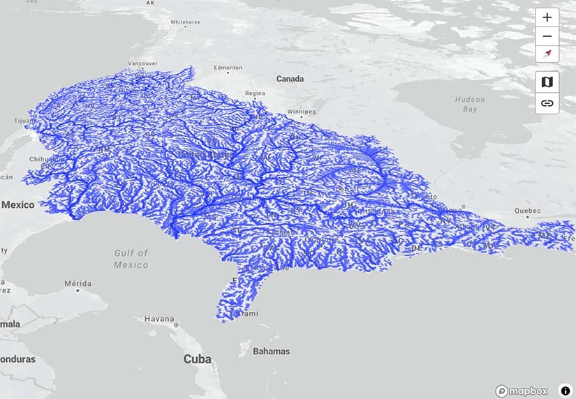
- High-resolution river network topology
- More than 1,400 dams, including at least 300 hydropower plants
- More than 800 thermal power plants (e.g., nuclear, coal, natural gas)
- Climate-water risk analyses for existing and projected thermal, hydropower, solar, and wind energy generation assets
- Climate-water impacts on thermal power and hydropower assets integrated into production cost and capacity expansion modeling (using PLEXOS, a commercial electricity production simulation model, and NREL's Regional Energy Deployment System, respectively).
Each U.S. region has unique climate conditions and power system characteristics. To understand climate and water impacts on future power systems, the NREL team used the Regional Energy Deployment System to incorporate asset-level vulnerabilities and energy demand impacts into capacity expansion modeling assessments.
For example, the team included vulnerabilities associated with thermal power, hydropower plants, and energy demand with caused by climate and water availability changes. This approach is based on an established workflow using an iterative modeling and data exchange platform that integrates climate-driven hydrological, thermal power plant, and capacity expansion models. Stakeholders can better understand impacts on the future bulk power system and strategies that may alleviate those impacts, such as alternative technology deployment choices.
Researchers used the Water Balance Model to model river flows, temperatures, and hydropower generation. The Water Balance Model is a hydrologic model with daily time steps and high spatial resolution that simulates vertical water balance and horizontal water transport along river networks and enables asset-level assessments of water risk and climate impacts.
With this model, the team executed an ensemble scenario analysis to better understand future water availability, thermal power vulnerabilities, and hydropower generation potential.
As flooding changes in both frequency and magnitude, flood hazards could impact power generation infrastructure. To understand how, the research team used the Water Balance Model to estimate river flows, flood exposure, and asset- and sub-basin-scale vulnerabilities across the United States for a range of hazard levels.
For example, the team considered historical data and future climate change scenarios, evaluated hydropower and thermal power plants at the asset level, and assessed a variety of energy generation types and substations in sub-basin-level analyses. With this data, the team can identify where flood risk is intensifying due to climate change.
Visualization and Analysis Tool
The Water Risk Visualization and Analysis Tool enables power grid stakeholders to better understand how climate and water risks, such as droughts and heavy rainfall, might impact their assets, regions, and systems.

The visualization tool features detailed data for:
- Dams, hydropower plants, thermal plants, and other power system assets
- Risk indicators for flooding and temperature extremes
- Aquatic habitat risk
- High-resolution river network topology and water cycle data, including precipitation, runoff, and river flows across the United States under a range of climate scenarios (from Coupled Model Intercomparison Project Phase 6)
- Capacity expansion results under climate and electric sector scenarios
- Grid dispatch results for high-to-low water constraint scenarios.
Partnerships
Stuart Cohen, Marty Schwarz, Nicholas Gilroy, Paul Susmarski, Sarah Awara, Jordan Macknick—National Renewable Energy Laboratory
Nalini Rao, Jonathan Lala—Electric Power Research Institute
Charles Vorosmarty, Hussain Bokhari, Fabio Corsi—City University of New York Advanced Science Research Center
Henriette Jager—Oak Ridge National Laboratory
Hyun Yoo—University of Tennessee
Nicole Jackson—Sandia National Laboratories
Erik Shuster—National Energy Technology Laboratory
Publications
Preparing the Power Sector To Navigate Climate and Water Risks, NREL Fact Sheet (2022)
Water Risk for the Bulk Power System: Asset to Grid Impacts, NREL Presentation (2022)
Contact
Share
Last Updated Jan. 8, 2025
