Geospatial Data Science Analysis
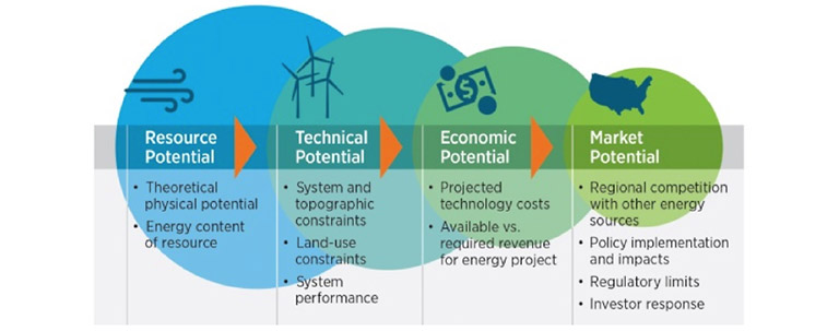
NREL's geospatial data science analysis uses renewable energy resource and geospatial data to characterize the viability of renewable energy technologies at different levels of technology maturity.

Geospatial analysis leverages manipulation of the spatial relationships in data. These data layers can be recombined, manipulated, and analyzed with other layers of information to create new data. This kind of analysis allows researchers to identify relationships between features, within a common layer, or across layers, and data can be queried or manipulated based on tabular and spatial characteristics.
Geospatial analysis questions researched by NREL include:
- Where are high-quality renewable energy resources available for development?
- Where are those resources located relative to existing infrastructure?
- What are the spatial and temporal variability characteristics of these resources?
- What are the land-use requirements and impacts of renewable energy deployment?
- What are the transmission and integration costs of renewable energy development?
- What are optimal designs for wind and solar generators across the country?
- What is the levelized cost of energy for different technologies across the nation?
Featured Analysis Products
Share
Last Updated March 7, 2025


