Wind Resource Maps and Data

Find and download wind resource map images and geospatial data for North America, the contiguous United States, Canada, Mexico, and Central America.

For more information on NREL's wind resource data development, see the Wind Integration National Dataset (WIND) Toolkit.

Maps

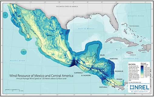
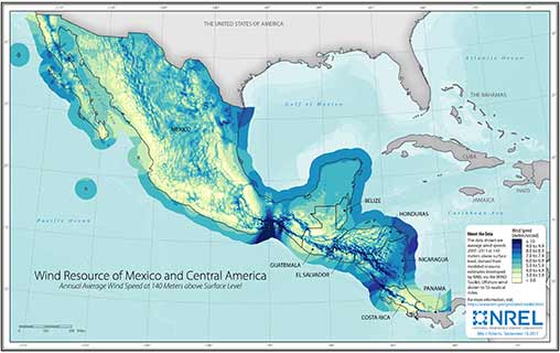
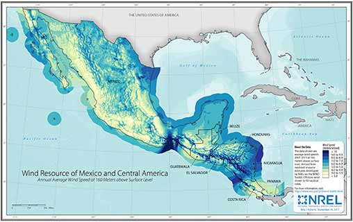
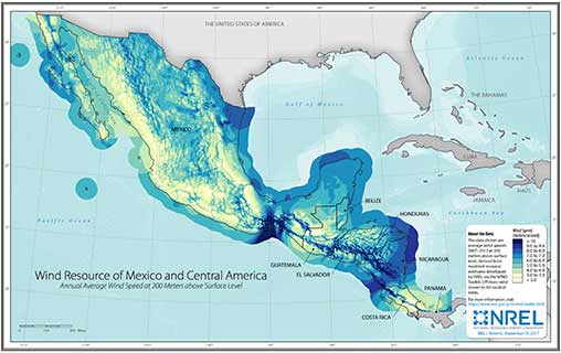
These static maps illustrate multiyear average wind speeds at various heights derived from NREL's WIND Toolkit. They may be used in electronic and printed publications with proper citation.

Note: The publication dates listed below don't necessarily reflect the publication dates of the data therein.

North America

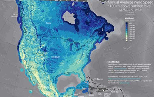
North American Annual Average Wind Speed at 100-Meter above Surface Level

North American Annual Average Wind Speed at 100-Meter Above Surface Level

Contiguous United States

Download the U.S. wind maps individually below, or download all the U.S. wind maps at once.

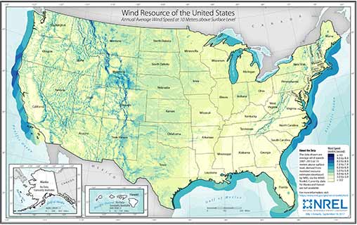
U.S. Wind Speed at 10-Meter above Surface Level

U.S. Wind Speed at 10-Meter Above Surface Level

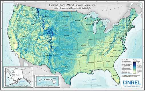
U.S. Wind Speed at 40-Meter above Surface Level

U.S. Wind Speed at 40-Meter Above Surface Level

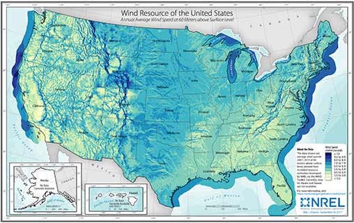
U.S. Wind Speed at 60-Meter above Surface Level

U.S. Wind Speed at 60-Meter Above Surface Level

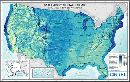
U.S. Wind Speed at 80-Meter above Surface Level

U.S. Wind Speed at 80-Meter Above Surface Level

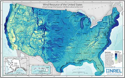
U.S. Wind Speed at 100-Meter above Surface Level

U.S. Wind Speed at 100-Meter Above Surface Level

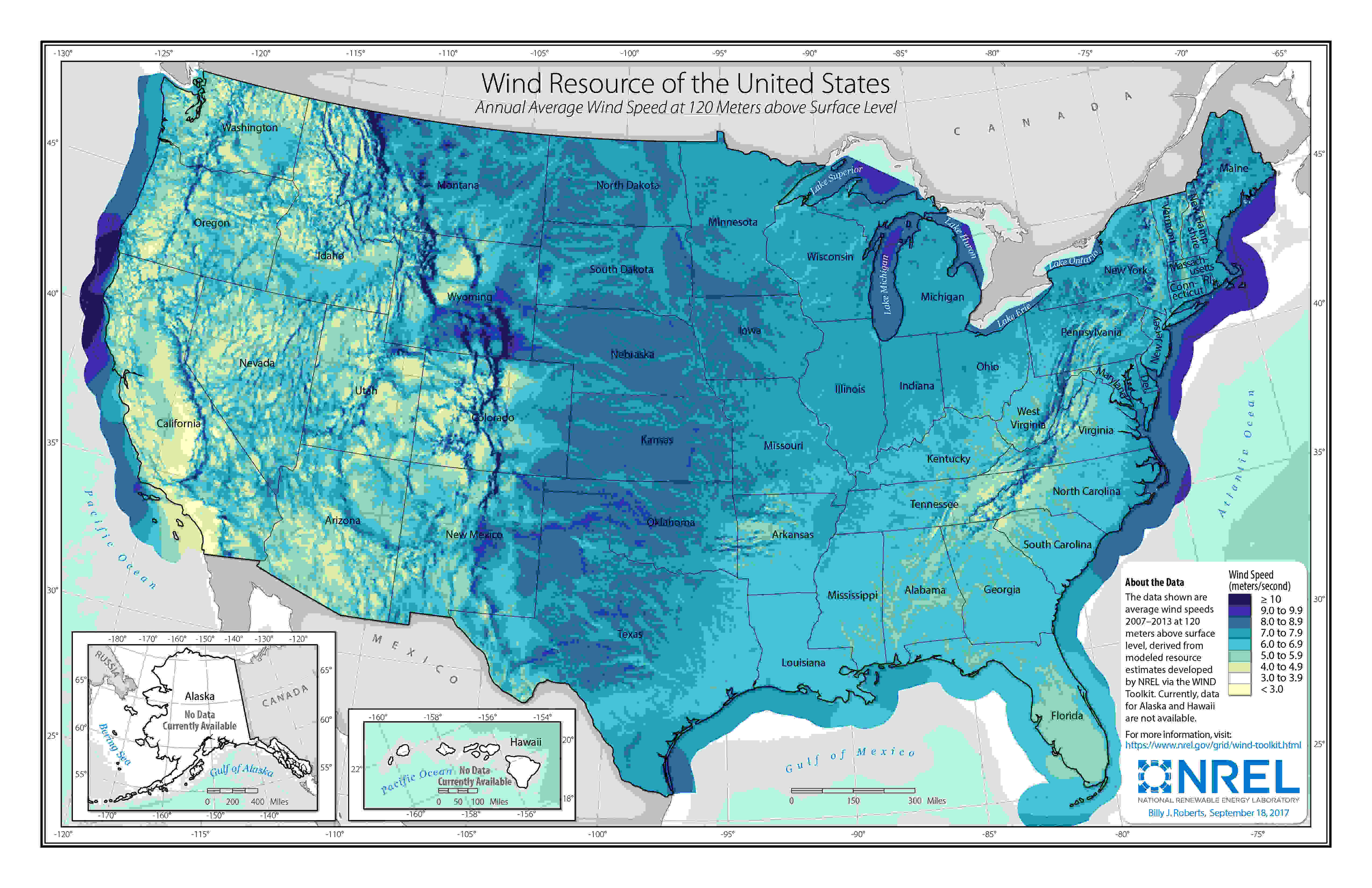
U.S. Wind Speed at 120-Meter above Surface Level

U.S. Wind Speed at 120-Meter Above Surface Level

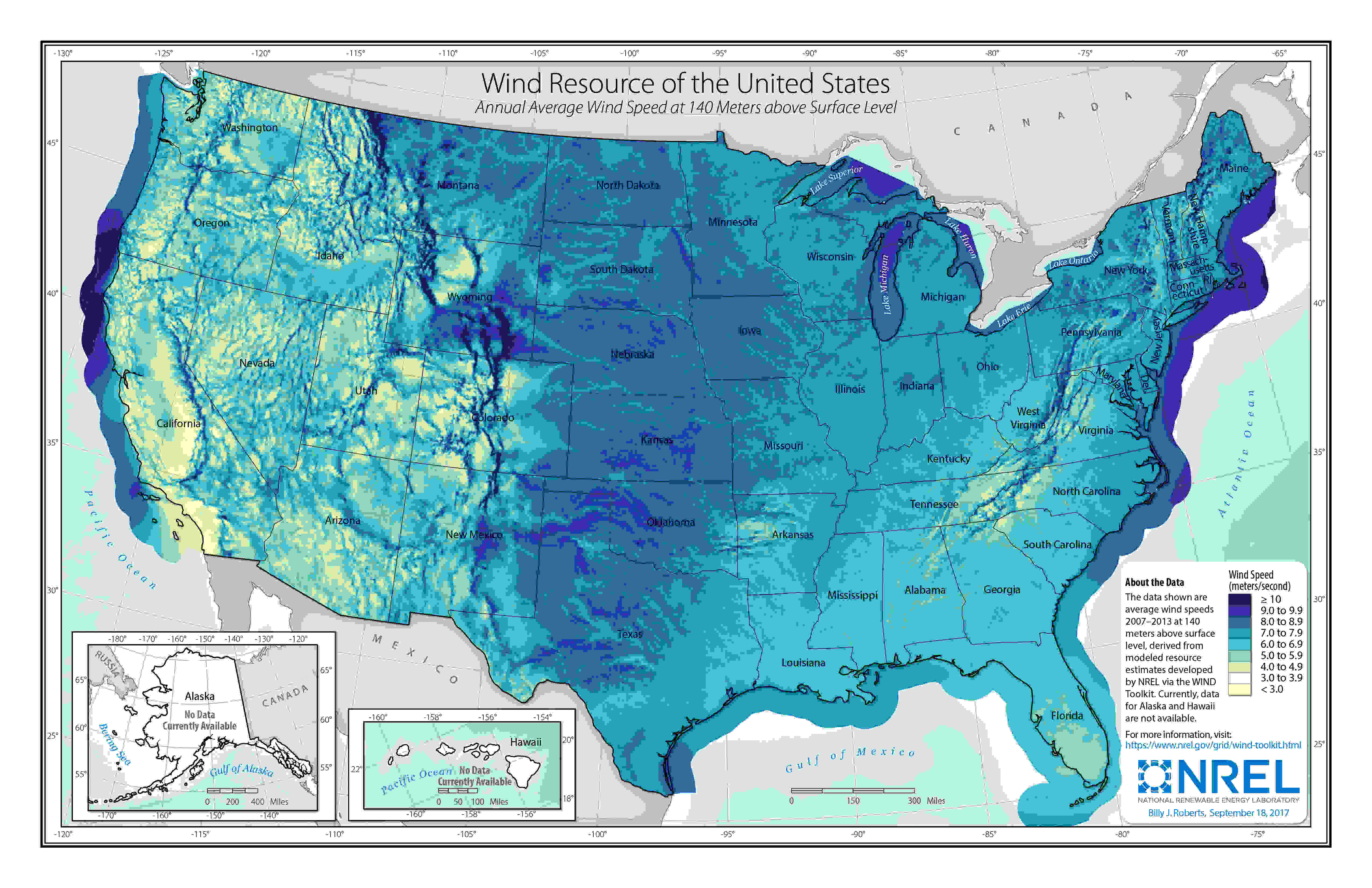
U.S. Wind Speed at 140-Meter above Surface Level

U.S. Wind Speed at 140-Meter Above Surface Level

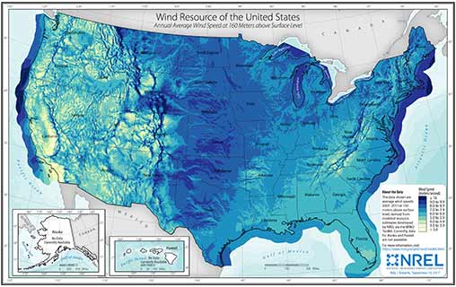
U.S. Wind Speed at 160-Meter above Surface Level

U.S. Wind Speed at 160-Meter Above Surface Level

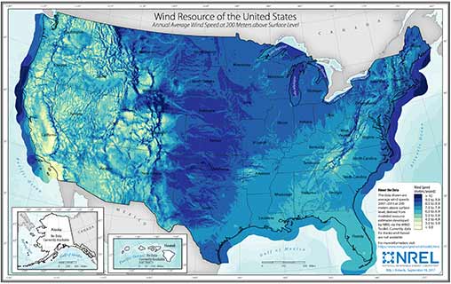
U.S. Wind Speed at 200-Meter above Surface Level

U.S. Wind Speed at 200-Meter Above Surface Level

Canada

Download the Canada wind maps individually below, or download all the Canada wind maps at once.

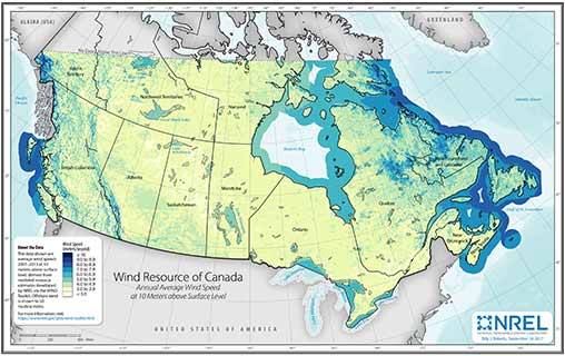
Canada Wind Speed at 10-Meter above Surface Level

Canada Wind Speed at 10-Meter Above Surface Level

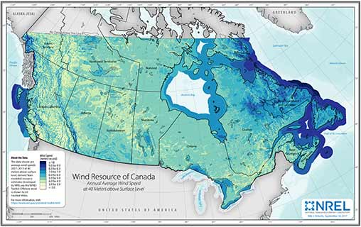
Canada Wind Speed at 40-Meter above Surface Level

Canada Wind Speed at 40-Meter Above Surface Level

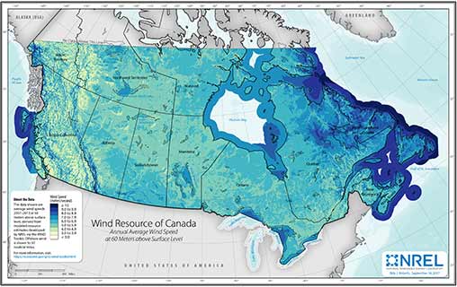
Canada Wind Speed at 60-Meter above Surface Level

Canada Wind Speed at 60-Meter Above Surface Level

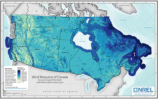
Canada Wind Speed at 80-Meter above Surface Level

Canada Wind Speed at 80-Meter Above Surface Level

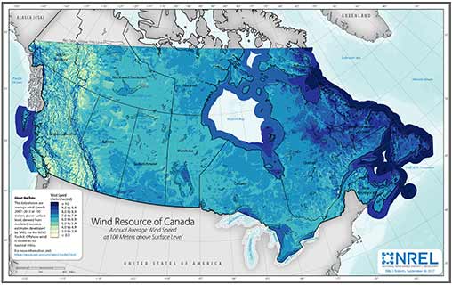
Canada Wind Speed at 100-Meter above Surface Level

Canada Wind Speed at 100-Meter Above Surface Level

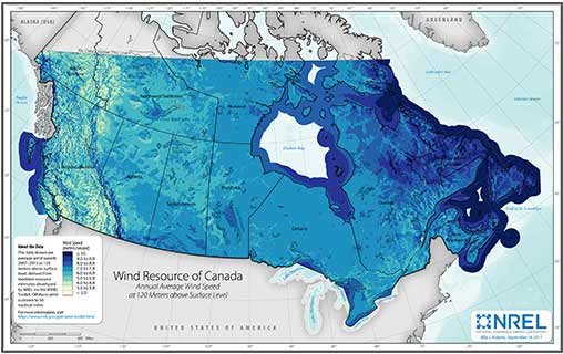
Canada Wind Speed at 120-Meter above Surface Level

Canada Wind Speed at 120-Meter Above Surface Level

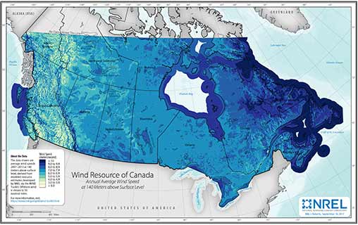
Canada Wind Speed at 140-Meter above Surface Level

Canada Wind Speed at 140-Meter Above Surface Level

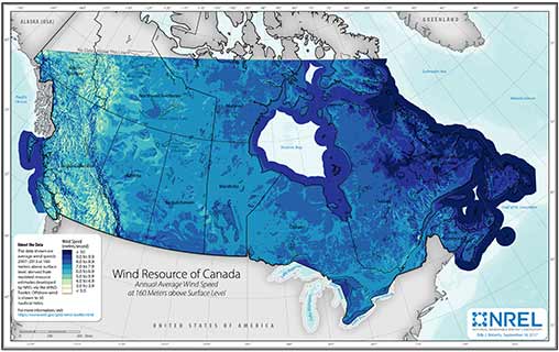
Canada Wind Speed at 160-Meter above Surface Level

Canada Wind Speed at 160-Meter Above Surface Level

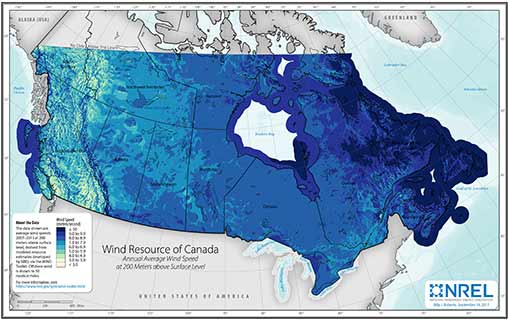
Canada Wind Speed at 200-Meter above Surface Level

Canada Wind Speed at 200-Meter Above Surface Level

Mexico and Central America

Download the Mexico wind maps individually below, or download all the Mexico and Central America wind maps at once.

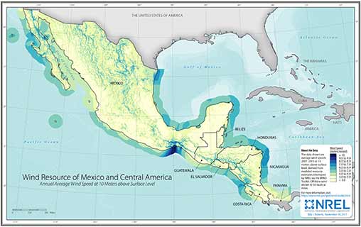
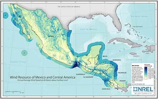
Mexico Wind Speed at 10-Meter above Surface Level

Mexico Wind Speed at 10-Meter Above Surface Level

Mexico Wind Speed at 40-Meter above Surface Level

Mexico Wind Speed at 40-Meter Above Surface Level

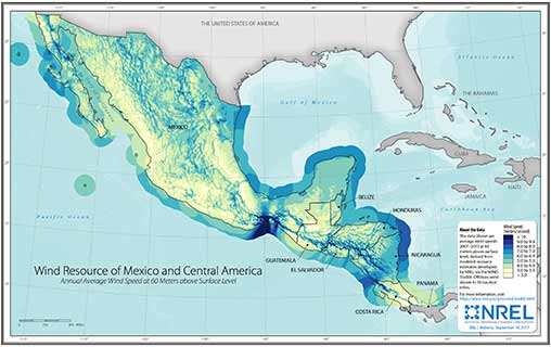
Mexico Wind Speed at 60-Meter above Surface Level

Mexico Wind Speed at 60-Meter Above Surface Level

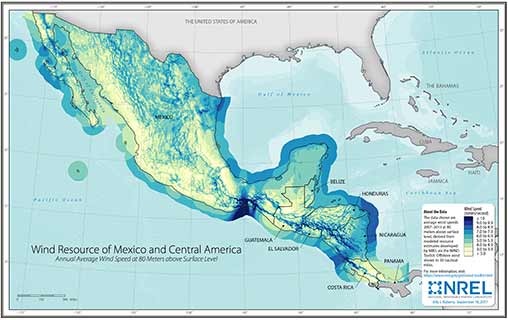
Mexico Wind Speed at 80-Meter above Surface Level

Mexico Wind Speed at 80-Meter Above Surface Level

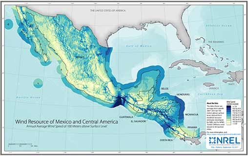
Mexico Wind Speed at 100-Meter above Surface Level

Mexico Wind Speed at 100-Meter Above Surface Level

Mexico Wind Speed at 120-Meter above Surface Level

Mexico Wind Speed at 120-Meter Above Surface Level

Mexico Wind Speed at 140-Meter above Surface Level

Mexico Wind Speed at 140-Meter Above Surface Level

Mexico Wind Speed at 160-Meter above Surface Level

Mexico Wind Speed at 160-Meter Above Surface Level

Mexico Wind Speed at 200-Meter above Surface Level

Mexico Wind Speed at 200-Meter Above Surface Level

Geospatial Data

To make the maps above, multiyear average wind speeds were calculated from the WIND Toolkit. The contiguous United States, Canada, and Mexico are separate analysis regions and were thus calculated individually. These derived data sets are provided below as geospatial rasters.

Note: To view and use these data sets, you need appropriate geographic information system software.

Cite the Maps and Data

Please cite use of the maps and data accordingly.

Draxl, C., B.M. Hodge, A. Clifton, and J. McCaa. 2015.  Overview and Meteorological Validation of the Wind Integration National Dataset Toolkit (Technical Report, NREL/TP-5000-61740). Golden, CO: National Renewable Energy Laboratory.

Draxl, C., B.M. Hodge, A. Clifton, and J. McCaa. 2015. "The Wind Integration National Dataset (WIND) Toolkit." Applied Energy 151: 355366.

Lieberman-Cribbin, W., C. Draxl, and A. Clifton. 2014.  Guide to Using the WIND Toolkit Validation Code (Technical Report, NREL/TP-5000-62595). Golden, CO: National Renewable Energy Laboratory.

King, J., A. Clifton, and B.M. Hodge. 2014.  Validation of Power Output for the WIND Toolkit (Technical Report, NREL/TP-5D00-61714). Golden, CO: National Renewable Energy Laboratory.

Contact

If you have any questions about the maps and data, please contact us.


Share

Last Updated Dec. 11, 2024